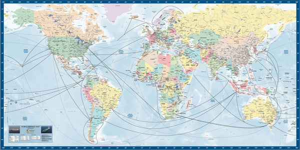
DG World Shipping Map
- Full color political data on national boundaries.
- Detailed information on cities and towns
- Shipping routes in High / Medium / Low density traffic formats.
- Tracks are color coded for pictorial traffic display.
- Over 130 major ports on all continents in highlighted color.
- Ports are color coded to show handling of Iron Ore / Oil / Containers / Coal.
This map can now be purchased as a Medium Resolution Digital PDF file, for use under license in your company IT system, providing all the members of the team with both identical and updated data on the relevant industry.
The Imagery License entitles the purchaser to install the imagery on each computer in the company, for research, marketing and operational functions. This license specifically prohibits the purchaser from reproducing the image in a hardcopy format, and providing the imagery and data to any third party.


