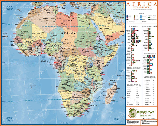
Africa - Top 60 Ports 2016.
Recently published in July 2016 by Business Maps Australia, this unique publication is possibly the first time a full colour, fully detailed political map has been completed that also displays the key shipping and commerce information found in this map. Data for this map and records was retrieved form a wide range of industry and national websites, as well as Lloyds Shipping.
Information included includes the following...
- Full Colour
- Full political borders and national data, including major towns and cities.
- The top 60 ports around the continent of Africa.
- Ports arranged in geographical regions in the Legend.
- Capital city and Regional ports delineated.
- 12 key products and services handled.
- Top 10 Oil producers - 2015
- Top 14 ports by tonnage - 2015
This map will be updated every 2 years, and the imagery itself can be customized to suit our clients specific needs. Large and Super map sizes; company logos; asset locations and other data can be overlaid as needed.
Please contact us for more information.


