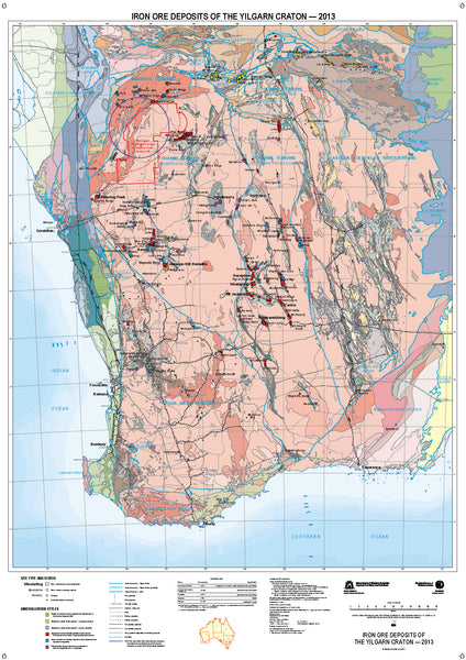
Yilgarn Craton 2013 - Iron Ore Deposits
Published by WA Department of Mines and Petroleum with 2013 data, this map provides highly detailed information on the company tenements, and mining operations in the Yilgarn region of Western Australia, relating to the Iron Ore deposits.
Included is the following..
- Names and positions of mining operations and mine sites.
- Color coding to show mineralization styles.
- Main road network of the area.
- Railway infrastructure.
- Gas pipelines.
- Grey coding to show variations and types of iron Ore geology.
Map supplied .. 1100 mm x 850 mm laminated
Allow 4 - 6 working days for delivery.
Data supplied by WA Department of Mines and Petroleum


