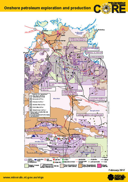
N. T. - Onshore Petroleum Production.
This map was published with data from 2018/ 19 from the Northern Territory Department of Mines and Petroleum, and displays the following information...
- Approved Onshore petroleum permits.
- Production leases.
- Gas discoveries.
- Gas fields.
- Oil fields.
- Combined Gas and Oil fields.
- Suspended fields.
- Gas and Oil pipelines.
- Proposed Gas pipelines.
- Roads and Railways.
- Petroleum wells.
- Companies involved in the fields.
- Colour plates referencing geological time strata.
This is a comprehensive display of oil and gas activity in this state, and contains the most up to data data.
The map can be produced to sizes suiting client needs, and we can overlay material such as logos, client assets and other items as needed.
Please allow 5 - 7 working days for shipment.


