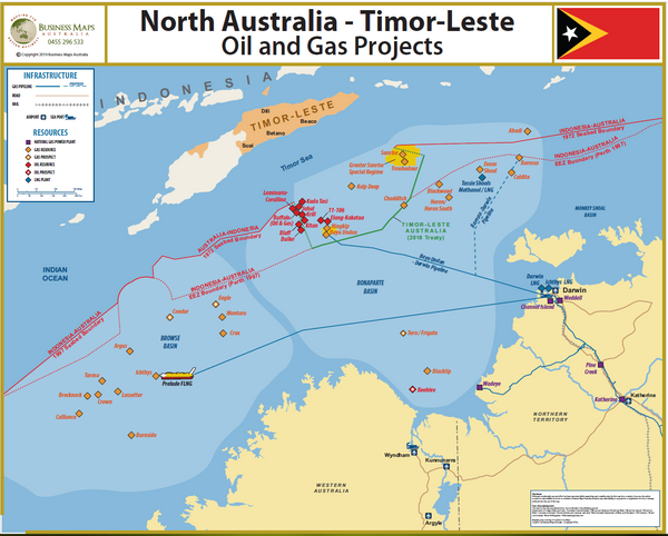
DG Timor-Leste Oil and Gas Projects
This map has just been published for the industry, and displays the new Maritime Boundaries recently ratified between Australia and Timor-Leste.
It also displays the oil and gas projects currently planned and operational in the region.
This map can now be purchased as a Medium Resolution Digital PDF file, for use under license in your company IT system, providing all the members of the team with both identical and updated data on the relevant industry.
The Imagery License entitles the purchaser to install the imagery on each computer in the company, for research, marketing and operational functions. This license specifically prohibits the purchaser from reproducing the image in a hardcopy format, and providing the imagery and data to any third party.


