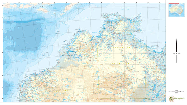
Cyclone Tracker Map * 1 - North Western Australia.
This customized Northern Australian map is designed for those companies who operate in northern waters affected by cyclonic weather patterns and events. This set of three maps provides..
- Data supplied by Geoscience Australia.
- Up to date political information on demographics and infrastructure.
- Spread of northern coast for eastern , western, and full northern waters perspectives.
- Topographic data to assist in preparing on land weather response and flood planning.
- Latitude / longitudinal grid for accurate systems plotting and asset location.
- Version 1 of this mapset covers Gulf of Carpentaria west - the Territory - to Western Australian coastline.
Maps are supplied printed on 160 gsm paper and laminated as standard.
Made to Measure Variations..
These maps can also be customized to include company logos and operations information, such as fixed asset positions, and can be produced to any size required. The data can also be direct printed onto a variety of mediums such as foam board, vinyl, aluminium and magnetic steel sheet for specific client needs.


