Australia - Mega Maps
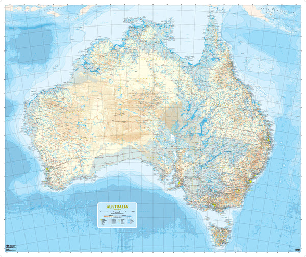
This colorful and highly detailed road map of Australia is the Australia General Reference map, published by Geoscience Australia. Covering 4,800,000 square kilometers, this map is topographically oriented to provide a clear accurate picture of the land forms of this great country, and includes the following road and towns information..
- Broad scale map of Continental Australia.
- All cities and major towns.
- All major and secondary roads.
- Color coded topographic information, including highly detailed waterways and lakes, and land elevations.
- Overview of ocean depths around the state.
Made to Measure Variations.. We can build this map of Australia to almost any size required, and supply it..
- Printed on standard or Premium paper.
- Paper and laminated
- On Self Adhesive Vinyl
- Magnetic Metal sheet
- white PVC Panel
- Waterproof PVC Vinyl.
Australia Special - The maps Continental Western Australia and Australia Eastern Seaboard are specifically designed to be assembled into one very large custom map of the country, and can be printed to almost any required size. The set are laminated, and shipped as two sections, for assembly onsite.


