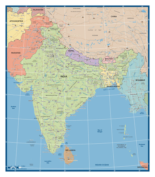
India 2015 - Custom Political Map
A newly published map of the subcontinent and India, and updated for 2015. All main and secondary cities are included, along with main road systems and waterways. This map also has significant near nation coverage, including Sri Lanka, Bangladesh, Nepal, Bhutan, Myanmar, Pakistan and southern China. A combination of this and the Chinese map provides a highly detailed perspective of the whole Sub Continent and Far East as a geographical whole.
The map can be set up to suit client needs in terms of..
- Overall dimensions of map size.
- India as a nation geographically.
- Sections of India to suit different projects.
- Sections of the map generally made to any specification.
- Company logos and relevant information overlaid.
Made to Measure Variations.. The example map is 1100 mm x 900 mm and supplied laminated, but the image can be produced in a variety of sizes, and include items such as company logos, fixed assett positions and trackable units. Imagery can also be presented as printed and mounted, or direct print onto materials such as foam board, vinyl, timber, Aluminium and magnetic sheet.
Please allow 5- 8 working days for delivery.


