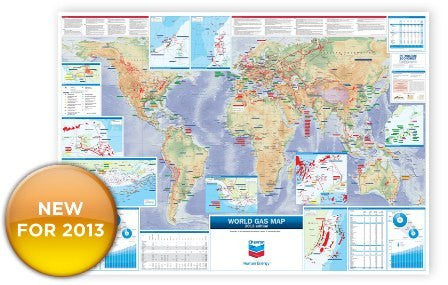
World Gas Map - 2014
Fully updated for 2014, the map now provides a comprehensive coverage of the global gas industry.
This map features:
- Gas fields
- Gas pipelines (including those under construction and planned)
- LNG import terminals and export plants (including those under constructions)
- GTL projects
Tables show:
- World gas production by region
- World gas consumption by region
- LNG trade movements, detailing exports and imports by country in Bn cm
- Primary natural gas demand forecast by region
- Timeline for 2012 detailing major developments in gas exploration, production, and discovery, by month
Inset maps show:
- Trinidad and Tobago
- Deepwater Gulf of Mexico (United States)
- Nigeria Delta and Offshore
- Northwest Shelf (Australia)
- Indonesia (Makassar Strait)
- Japan (LNG import terminals)
- UK (West of Shetland)
- Norwegian Sea
- Canada West Coast (British Columbia)
Map Supplied.. 1180 mm x 920 mm.
Allow 6 - 8 working days for delivery.


